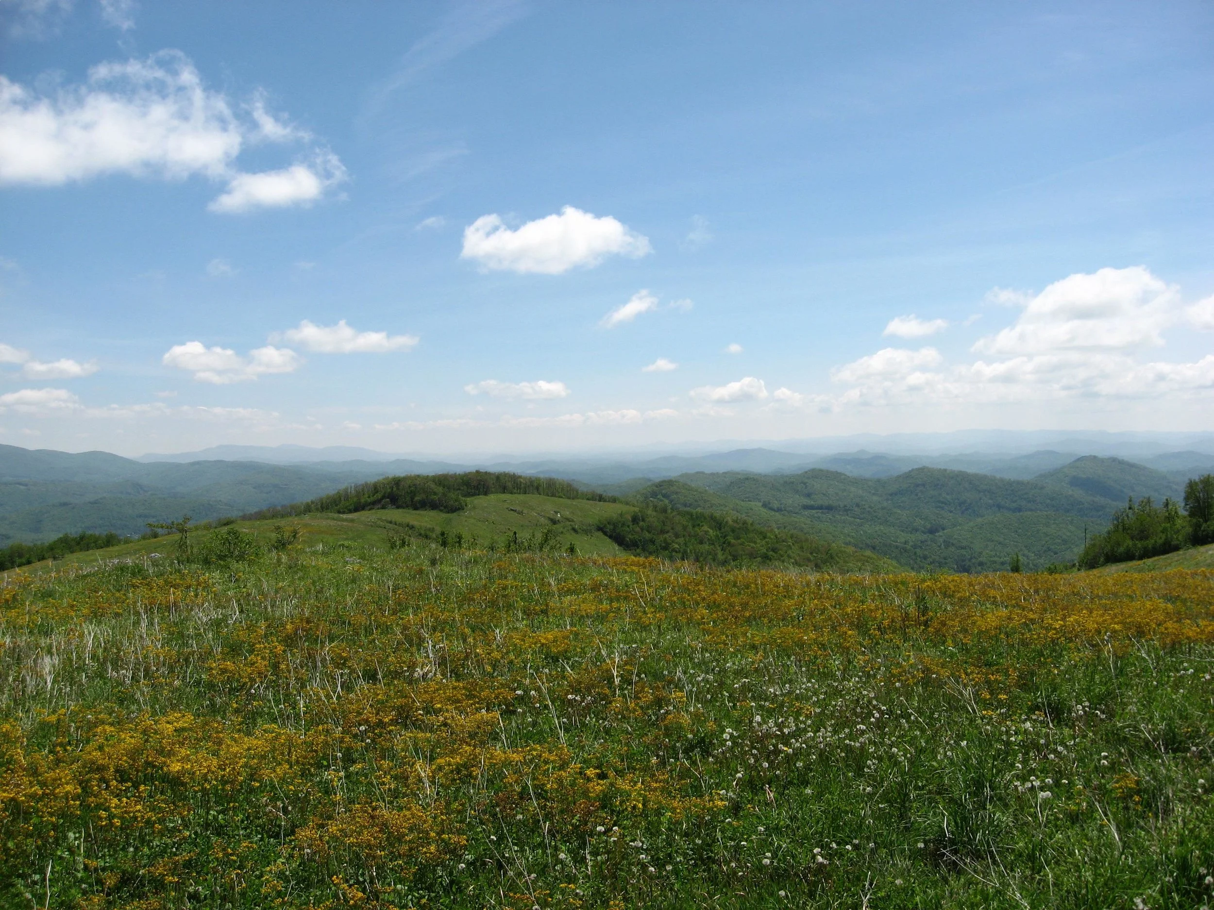
Pond Mountain Game Lands
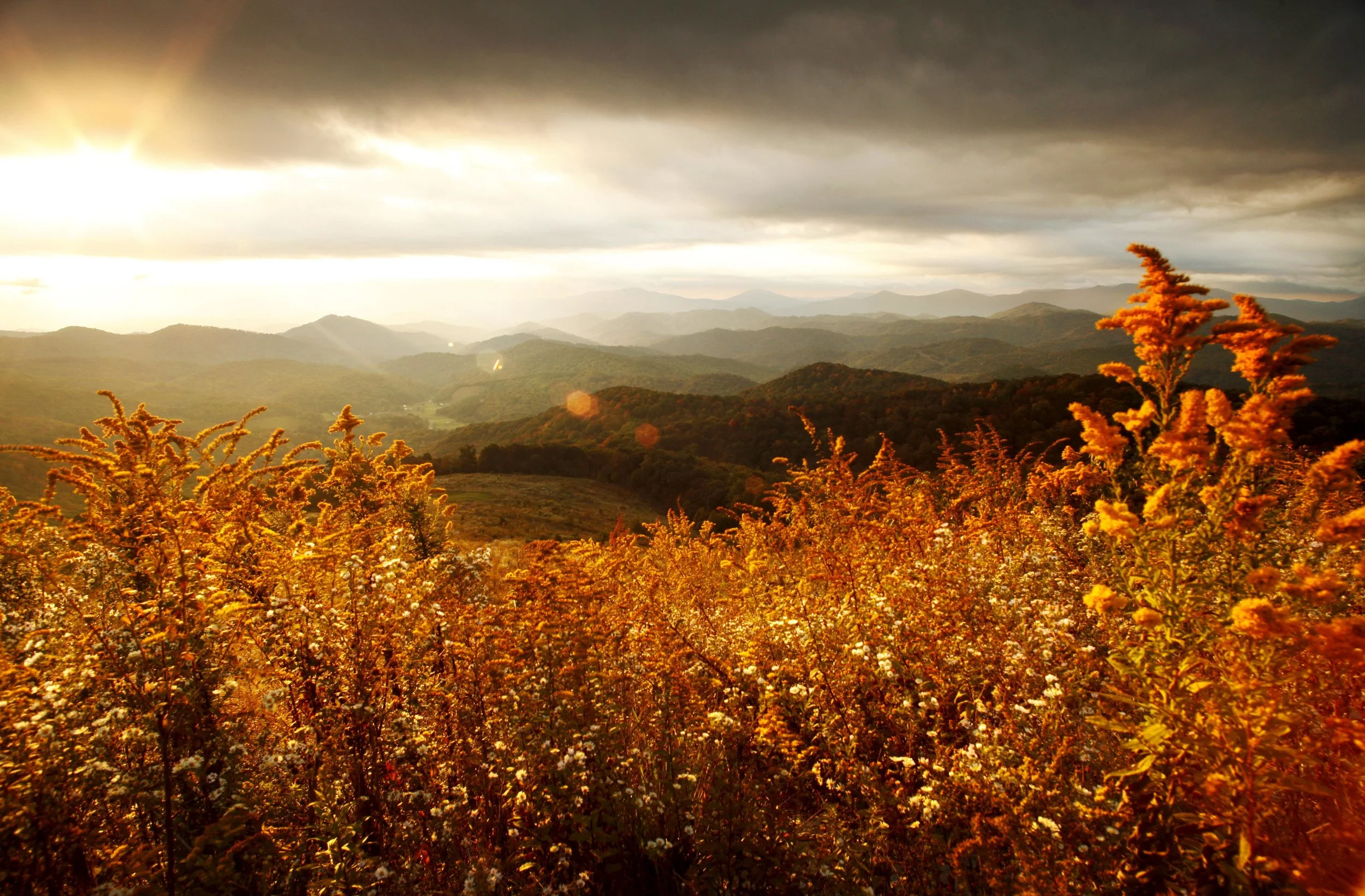
Blue Ridge Conservancy partnered with NC Wildlife Resources Commission in 2008 to create the Pond Mountain Game Lands in northwest Ashe County. At 5,000 feet elevation, Pond Mountain overlooks the mountains of Virginia, Tennessee and North Carolina. Immediately to the north are the peaks of Virginia’s Grayson Highlands State Park and Jefferson National Forest, Mount Rogers, and White Top Mountain. To the west lies Tennessee’s expansive Cherokee National Forest. Visible to the east and south are the high peaks of North Carolina’s Blue Ridge. Pond Mountain is about a 30-minute drive from the mountain community of West Jefferson.
Thomas Jefferson’s father, Peter Jefferson, gave Pond Mountain its name in the 1700s after he surveyed the line that would become the border of North Carolina and Virginia. Jefferson chose the name because of the many natural ponds that dotted the mountain’s high ridgeline. The historic ponds point to the mountain’s special significance as an important water resource. Several important streams and creeks originate on Pond Mountain, including Big Laurel, Ripshin and Big Horse Creeks, all of which flow into the New River, a National Heritage River and one of the oldest rivers in the world.

In addition to preserving the region’s natural beauty and vital water resources, the protection of Pond Mountain is important for wildlife. Because of the mountain’s close proximity to Cherokee National Forest and Jefferson National Forest, protecting the area greatly expands wildlife habitat, including habitats highlighted in North Carolina’s State Wildlife Action Plan (SWAP).
Through several acquisitions over the past eight years, Pond Mountain now offers one of the largest public access game land properties in northwest North Carolina. The 2,900 acre game lands allows recreational opportunities such as horseback riding, hiking, fishing, hunting, and cross country skiing.
Currently under Christmas tree cultivation, the project offers major environmental benefits by presenting an opportunity to restore a high mountain habitat to a thriving natural area.
Please be mindful of hunting seasons and regulations when visiting Game Lands. More information can be found at www.ncwildlife.org.
http://www.ncwildlife.org/Portals/0/Hunting/Game-Land-Maps/Mountain/Pond-Mountain.pdf
+ Directions from Boone
Follow US-421 N/W King St through downtown Boone / Continue to follow US-421 N / Entering Tennessee 22.1 mi / Continue on TN-167 N/Forge Creek Rd. Take S Flatwoods Rd and Flatwoods School Rd to Rock Fence Rd in Pond Mountain 14.8 mi / Turn right onto TN-167 N/Forge Creek Rd Entering North Carolina 7.1 mi / Continue onto Big Laurel Rd 0.4 mi / Turn left onto S Flatwoods Rd 2.4 mi / Continue onto Flatwoods Post Office Rd 1.0 mi / Slight right onto Flatwoods Rd 1.0 mi / Continue onto Flatwoods School Rd 1.1 mi / Turn right to stay on Flatwoods School Rd 1.1 mi / Turn right onto Rock Fence Rd 0.8 mi / Rock Fence Road Lansing, NC 28643
+ Directions From West Jefferson
West Jefferson, NC / Follow NC-194 N to E Little Horse Creek Rd in Piney Creek 16 min (9.7 mi) / Head north on NC-194 N/N Jefferson Ave toward W 3rd St / Continue to follow NC-194 N 1.5 mi / Turn left onto NC-194 N/NC-88 W 3.8 mi / Turn right onto NC-194 N 3.7 mi / Continue straight onto S Big Horse Creek Rd 0.7 mi / Continue on E Little Horse Creek Rd. Take Joe Hampton Rd, Coy Ham Rd and Fairview Church Rd to Rock Fence Rd in Horse Creek 26 min (10.3 mi) / Turn left onto E Little Horse Creek Rd 2.3 mi / Turn left onto Joe Hampton Rd 1.7 mi / Continue onto Stansberry Rd 1.3 mi / Continue onto Little Horse Creek Rd 0.7 mi / Continue onto Coy Ham Rd 1.4 mi / Turn right to stay on Coy Ham Rd 0.7 mi / Turn left onto Fairview Church Rd 1.5 mi / Turn right onto Rock Fence Rd 0.8 mi / Rock Fence Road Lansing, NC 28643